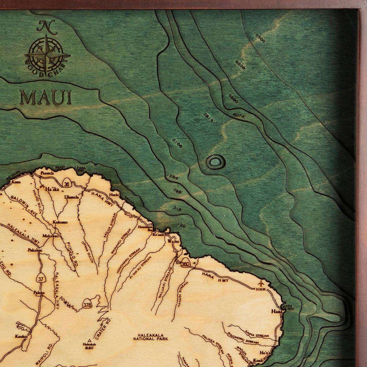
Maui Nautical Wood Map in Frame
Maui Nautical Wood Map in Frame
Regular price
$229.00
Regular price
Sale price
$229.00
Unit price
per
Shipping calculated at checkout.
SKU:CHAR39829
The second largest of the Hawaiian Islands, the island of Maui stretches out to an impressive 727 square miles, making it the 17th largest in the United States. Nestled in the Central Pacific, this well-known and highly sought-after area is part of the Hawaiian archipelago with the sprawling Haleakala National Park which encompasses the island’s highest peak, volcanic Haleakala, and is well known for its winding Hana Highway and the waterfalls and pools of Ohe’o Gulch. Peppered with artist communities and quaint little towns, Maui is often referred to as the “Valley Isle” and with an average population of 144,444, it comes in third with its volume of residence - just behind those islands of O’ahu and Hawai’i Island. From the 30 miles of shimmering beaches to the breathtaking sunsets and migrating humpback whales, it’s no wonder why Maui has been voted best island for more than twenty years.
Size:
16 x 20
Availability:
In stock. Fast Shipping!
SKU:
ME-Maui-S
Also Available:
View Grey Frame Here
Details
• 3D underwater topographic map (bathymetric chart)
• Framed in solid wood, ready to hang
• Protected by crystal clear Plexiglas
• Layered laser cut natural Baltic Birch wood
• Carved relief of nautical terrain
• Wooden chart work of art that will enhance any décor
• Locations etched & highlighted with special technique
• Color may slightly vary from images shown
Shipping
All shipments may take a MINIMUM OF FIVE BUSINESS DAYS to be received as we are shipping from Hawaii. Our shipping services do not guarantee two-day delivery from Hawaii. We will send an email notification when your order is shipped.
***PLEASE ""CLICK HERE"" FOR ADDITIONAL IMPORTANT SHIPPING INFO***
Couldn't load pickup availability